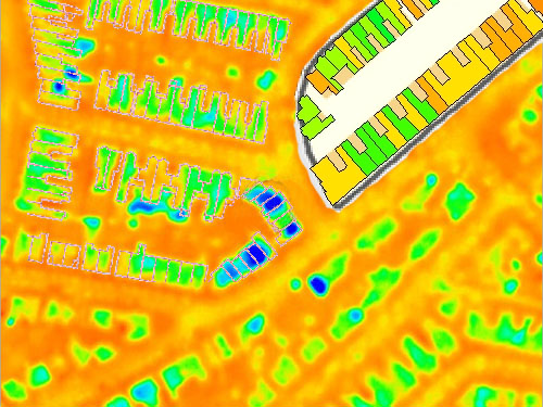
Heat loss assessed via a digital infrared camera,
bottom of image.
Overlaid with a digital map of the city, top left.
Average heat loss calculated for each property, top right.
Heat loss assessed via a digital infrared camera,
bottom of image.
Overlaid with a digital map of the city, top left.
Average heat loss calculated for each property, top right.